Acquafraggia Valley
Piuro, Sondrio
June 2019
We are in Bregaglia valley, a few kilometres from the border with Switzerland, on the road that leads to St. Moritz, along the river Mera, a tributary of lake Como. The hamlet Borgonuovo (literally New Village) owes its name to the reconstruction that took place following the huge landslide of mountain Conto, which in 1618 deleted the rich and cultured city of Piuro and almost all its 1200 inhabitants.
The current territory of Piuro extends northwards with an area of 84 km² through the Acquafraggia valley and the Lei valley up to Switzerland. I will tell you about the Lei valley one day when I got there on foot. The Acquafraggia valley takes its name from a stream, emissary of a lake of glacial origin at an altitude of 2043 meters.
The toponym Acquafraggia derives from the Latin Aqua Fracta, which indicates a stream continuously interrupted by waterfalls, among these, before entering the river Mera, the monumental waterfalls of Aquafraggia stand out, two distinct double-step waterfalls about 170 meters high.
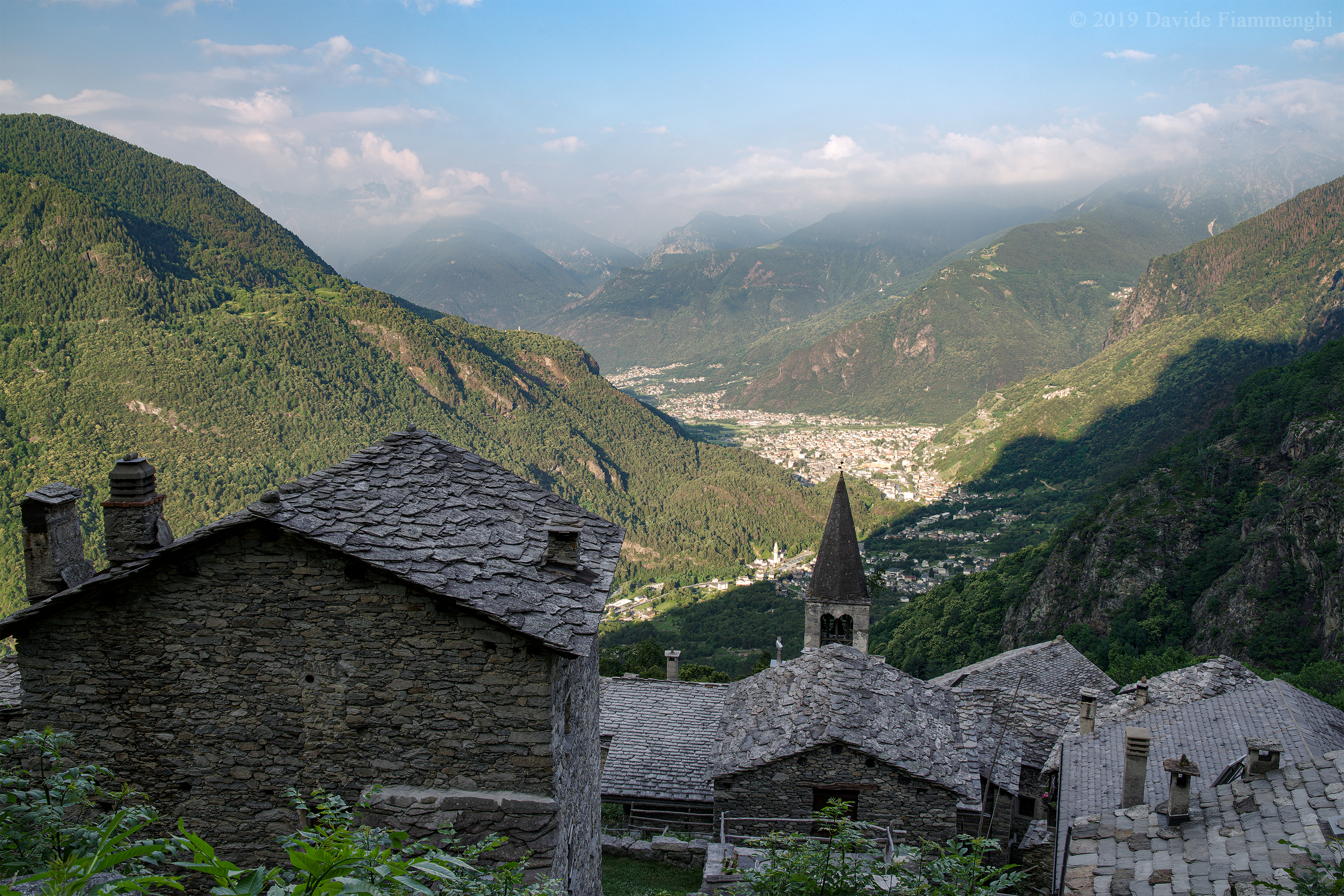
Above the waterfalls, perched on a natural terrace, you can see Savogno (932 m), an ancient medieval village through which people once traveled to go to Chur, the capital of the Three Leagues, currently in Switzerland. From the first documentation of the 210 inhabitants of the year 1628, and the statistics of 247 inhabitants of 1866, since 1968 it was definitively abandoned and today it is inhabited by 2 refugists and 3 other persons, plus the families who return in summer to occupy homes of their ancestors. Time seems to stand still in Savogno.
In this photo taken at 7:00 a.m. you can see the houses at the top of Savogno, the bell tower of the parish church to San Bernardino, consecrated in 1465, and the panorama on the Bregaglia valley and the city of Chiavenna. The image was processed from a exposure bracketing, with a circular polarizing filter.
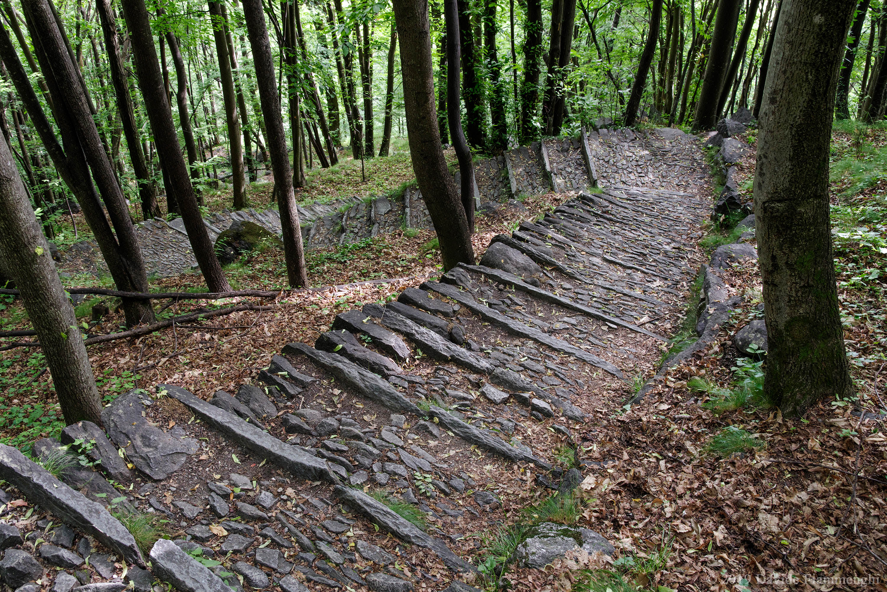
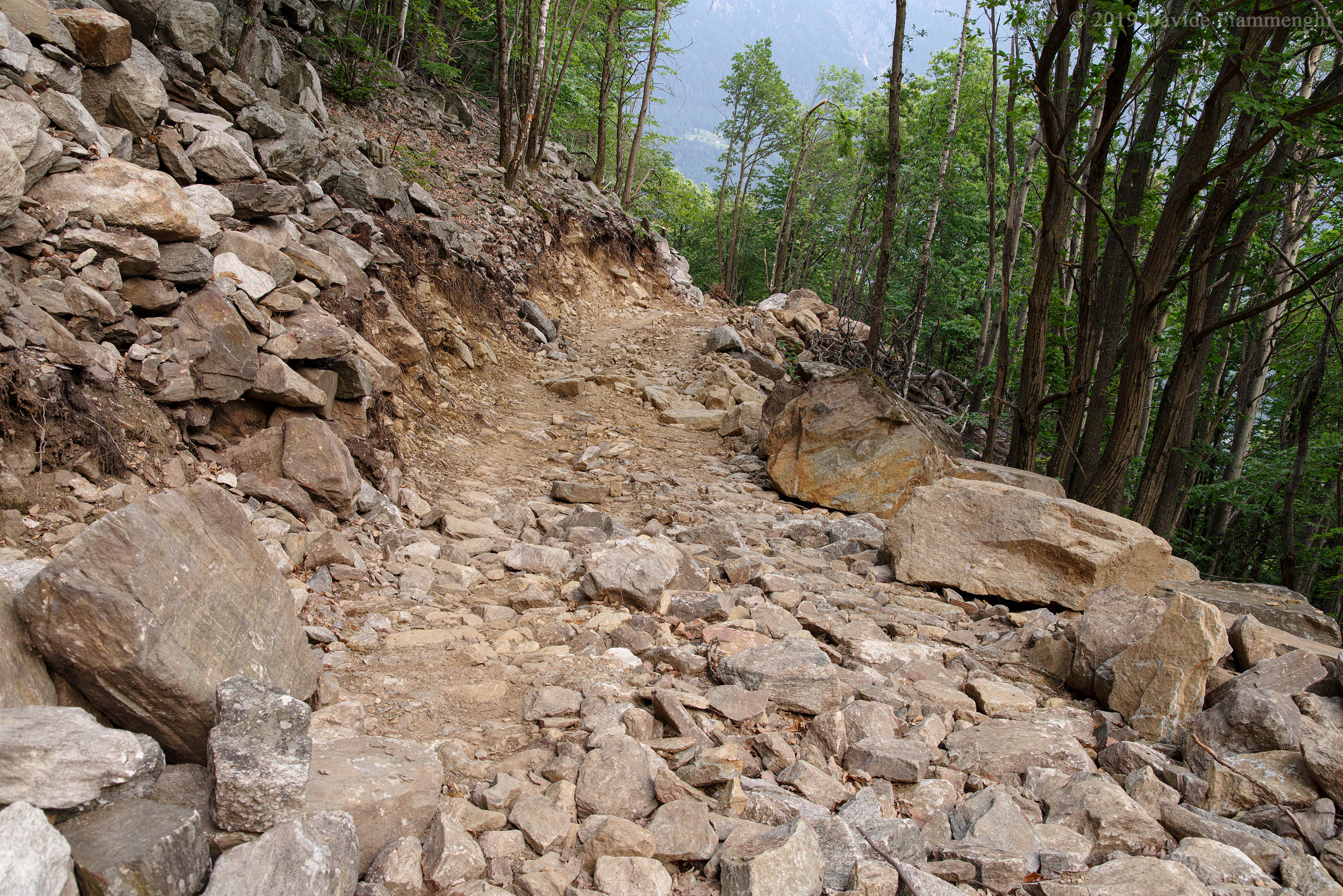
The normal path to Savogno begins in the Sarlone area near the Acquafraggia waterfalls, with a vertical drop of 500 meters, through a 2886 steps staircase resting on the rock.
This time I’m heading for the lake of Acquafraggia and my trip starts the night before, when I camp to spend the night in the woods at the end of the vehicle accessible part of the forest road Bregalone-Savogno, the transit requires a pass for sale at some café in Piuro. At 6:30 a.m. I set off and I meet construction labourers starting to work. In fact, the third 2,8 km batch of the road is under construction and will lead to the village of Medieval origin, after 600 years in which it was reachable only on foot.
The hike is not short, an altitude difference of 1000 metres is waiting for me, I walk the stone steps beyond Savogno. I come across a chapel to Saint Anthony that bears the inscription “Il paradiso costa fatica ma è bello” (literally Heaven costs effort but it is beautiful), a rather simple concept which however will acquire meaning when I arrive at the lake, which is truly a heaven.
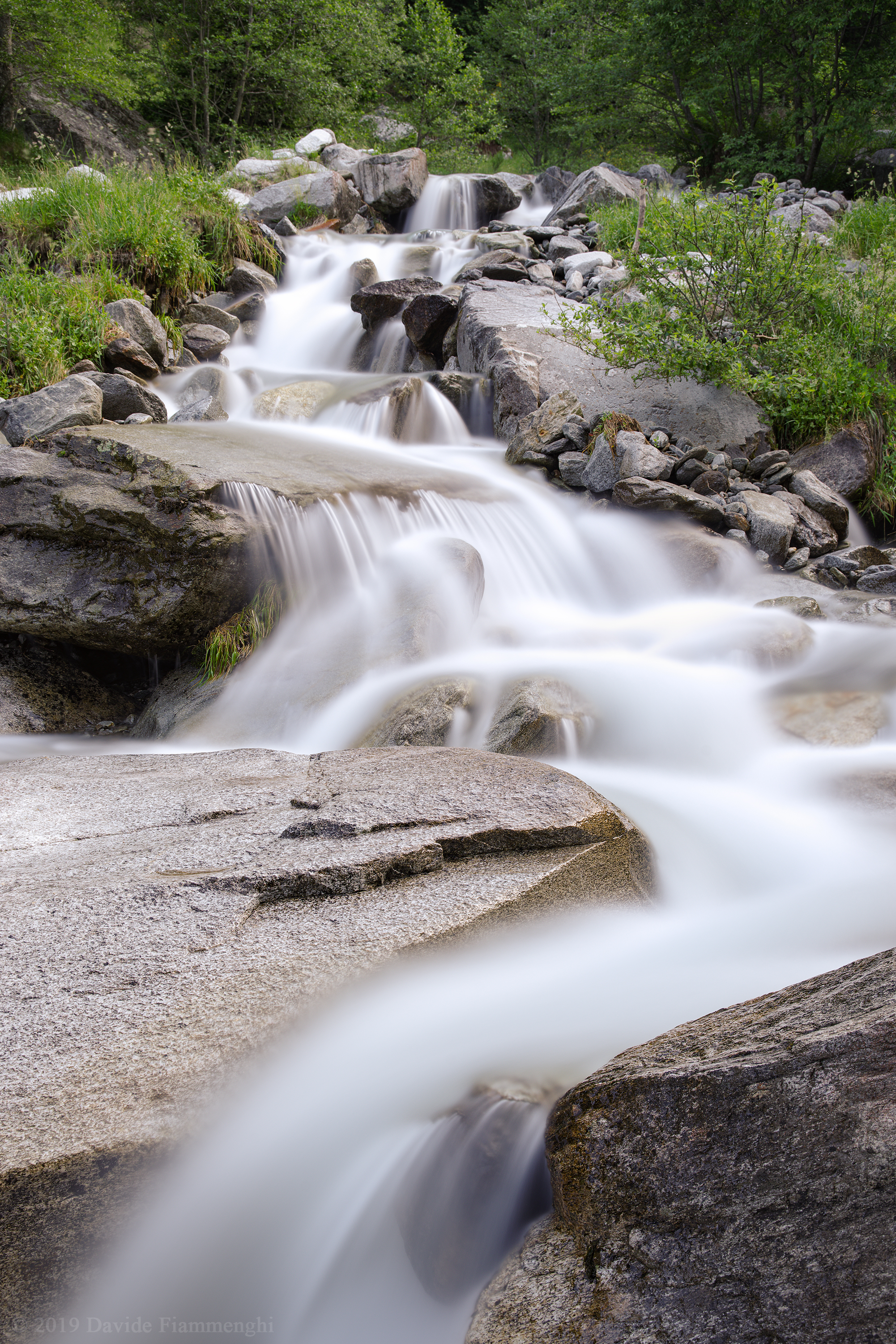
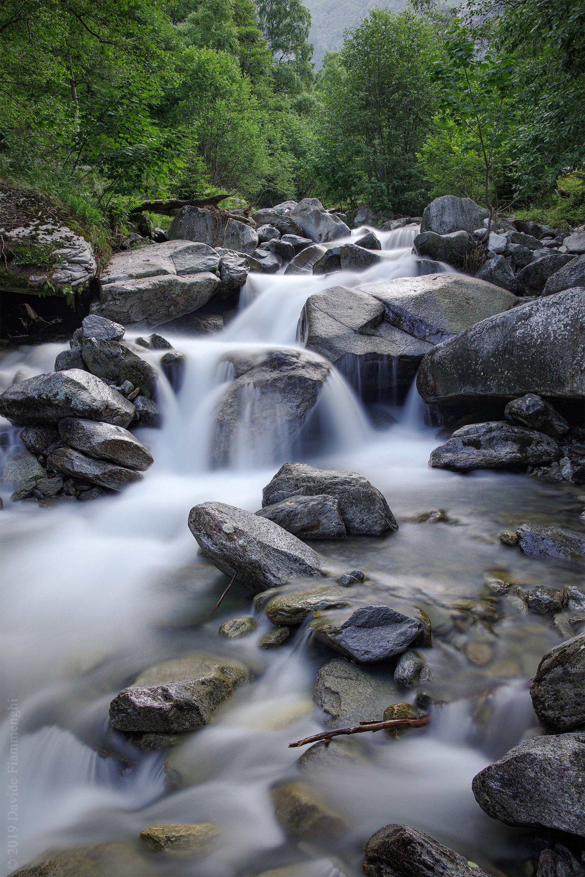
Along the path I find a multitude of waterfalls that invite you to linger to take photos. These two images are obtained with single long exposures with ND 500, a filter that reduces the amount of light entering the lens to 0.2%.
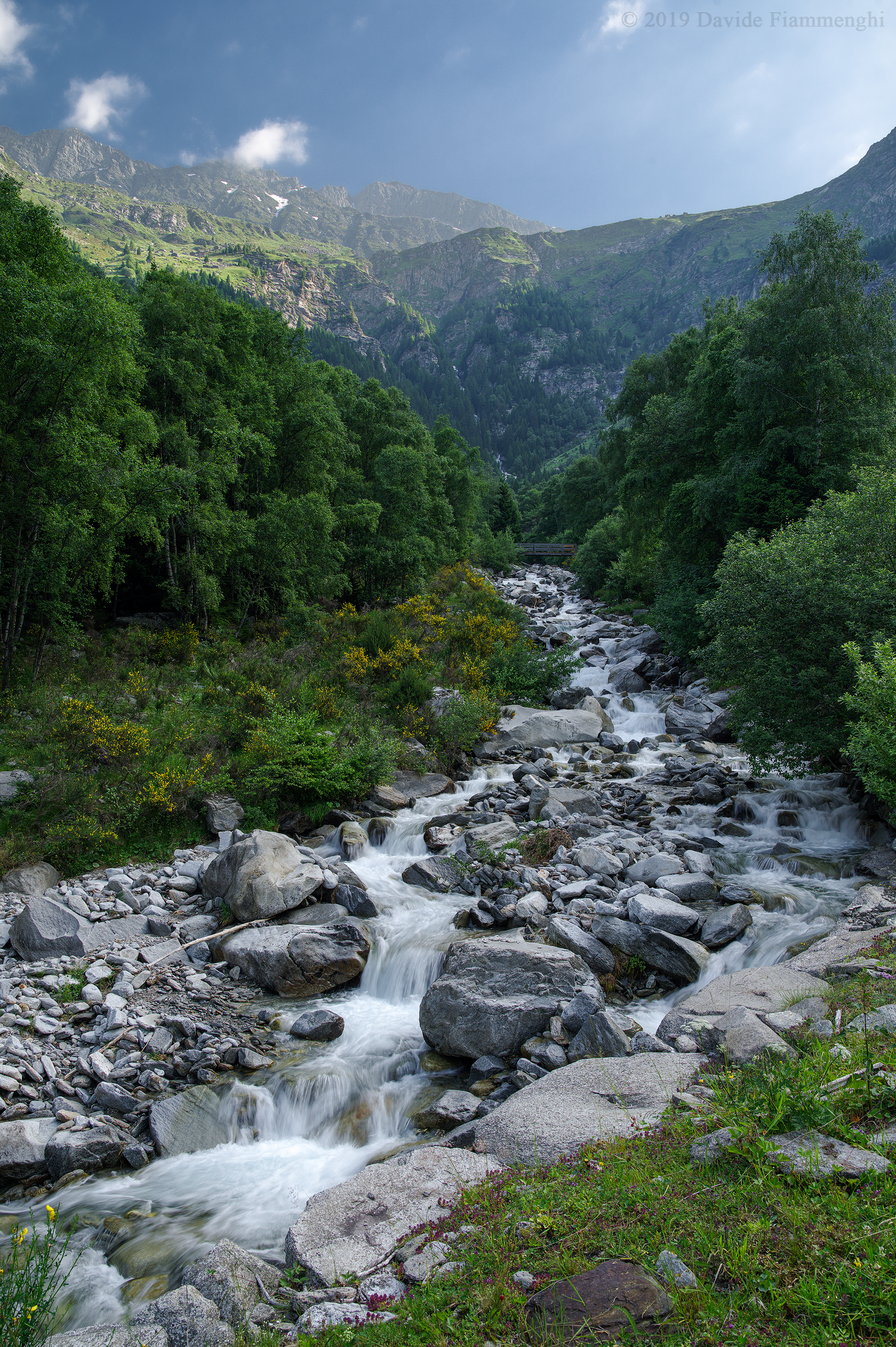
At the end of the staircase I come out the forest and the path, once a transhumance route, continues merging with the grass. I walk along old ruins and stone houses still inhabited by local shepherds, meeting groups of cows on the mountain pasture. Here the stream becomes wider and less impetuous, in a valley still in the shade at 8:30 in the morning.
In this double exposure photo I made sure that both the stream and the Ponciagna alp lit by the morning sun were clearly legible.
A long walk is still ahead of me. After crossing the stream near a group of buildings, the steepest part of the path begins. I climb the alp Ponciagna (1816 m) where I find myself immersed in a luxuriant nature, with a large rainbow of flowers, beetles, butterflies and other insects.
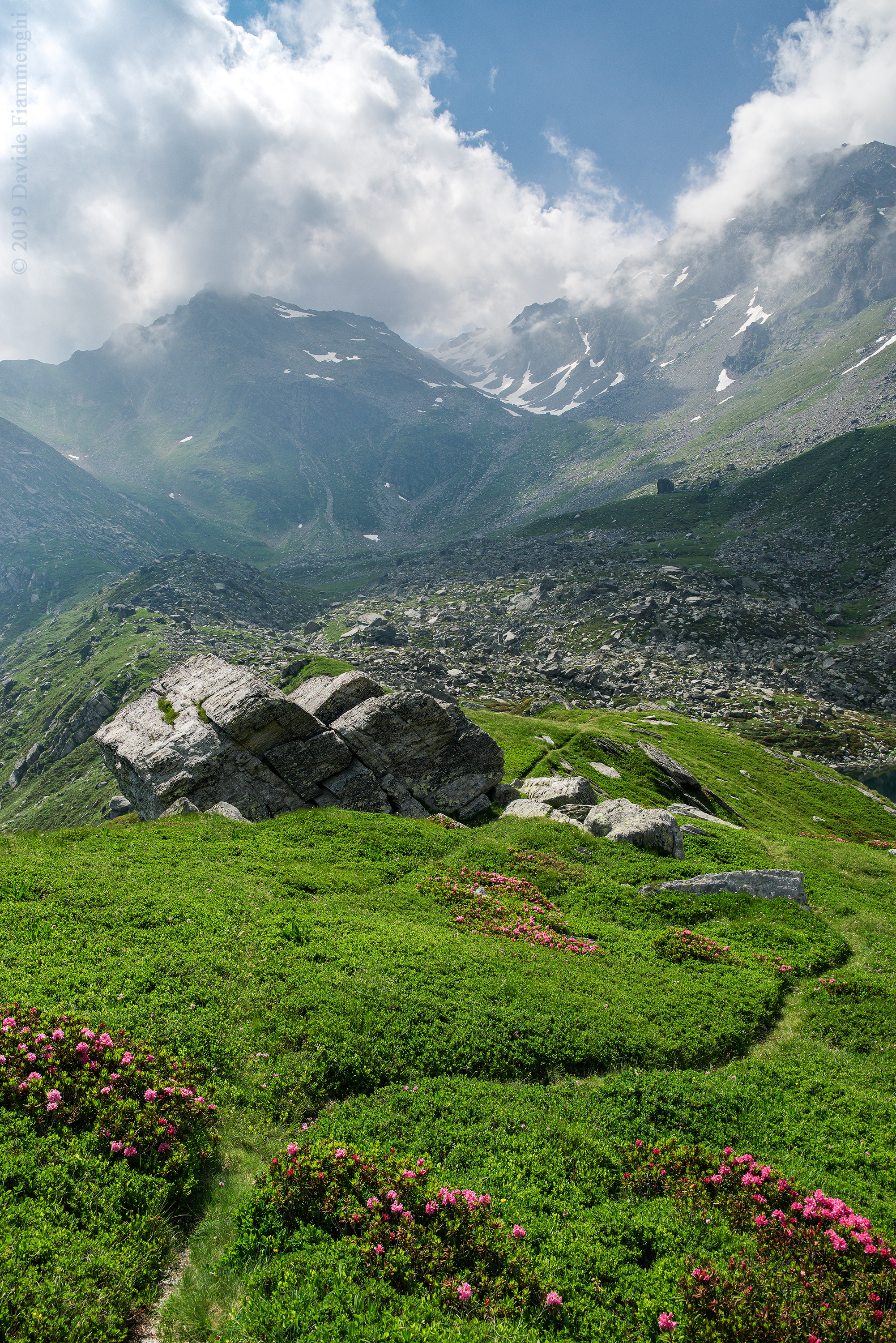
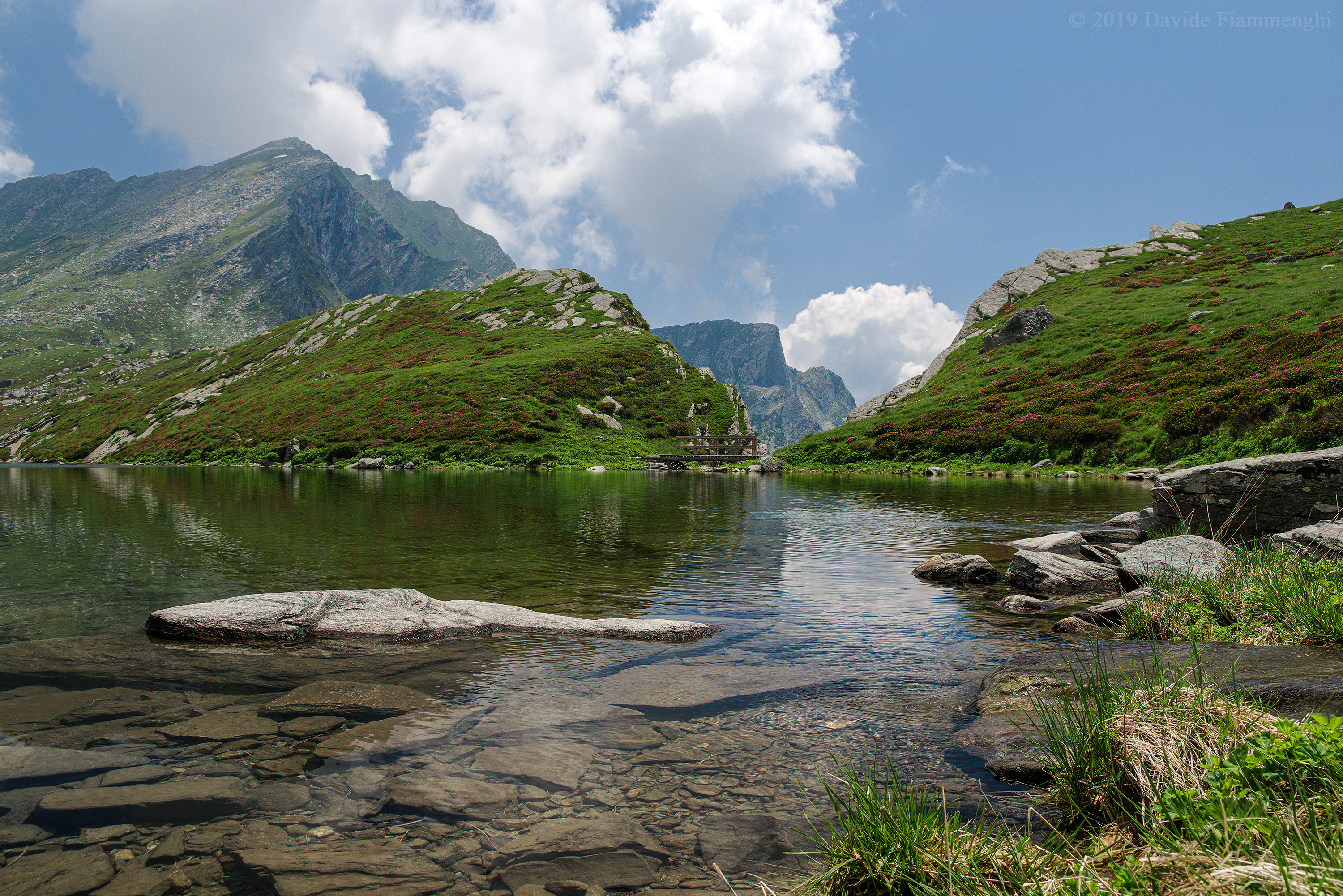
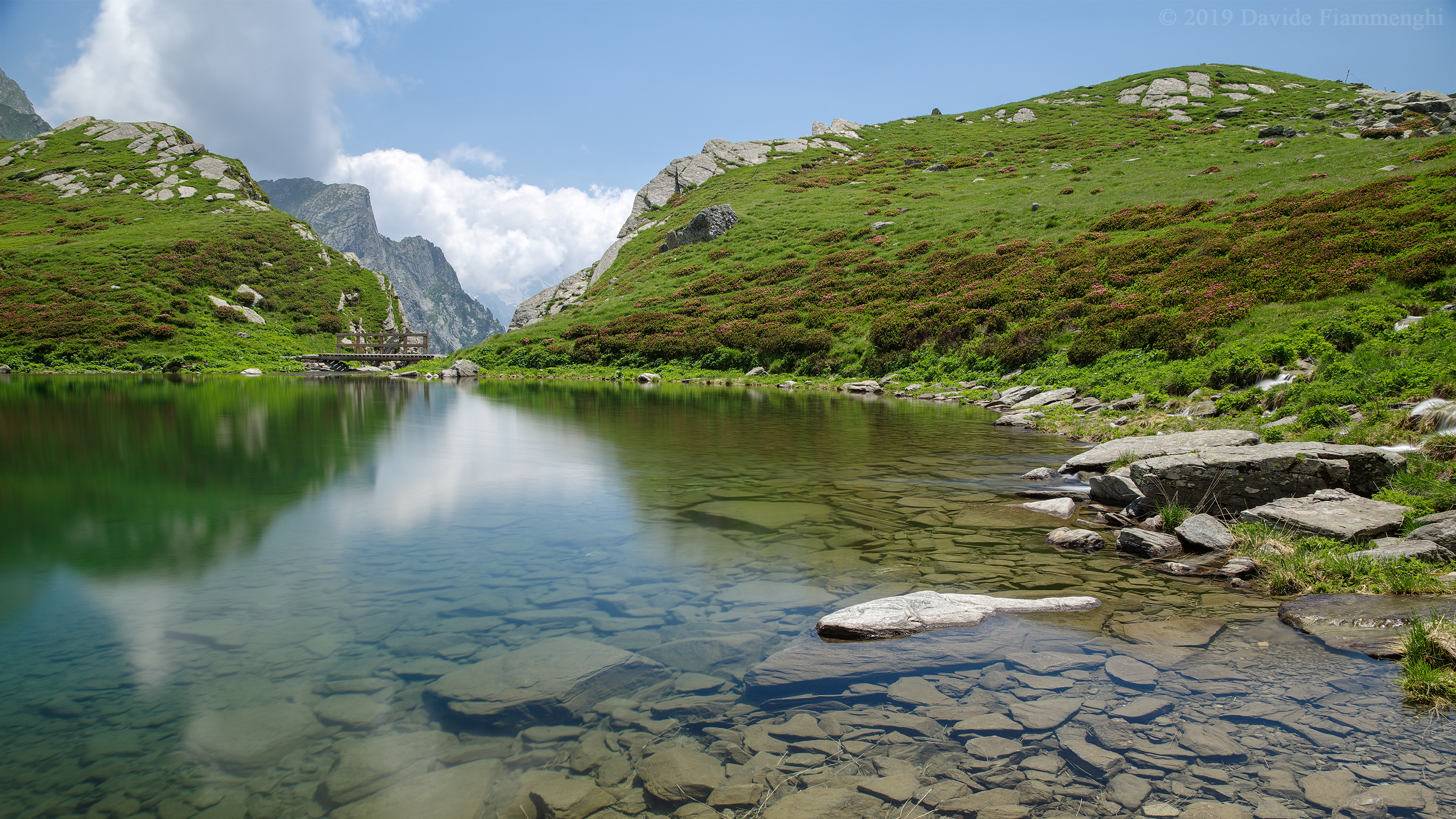
Finally around half past noon I reach the lake of Acquafraggia (2043 m). A basin of glacial origin surrounded by mountains, including the highest peaks Pizz Gallagiun (3107 m) and Cima da Lägh (3083 m), on the slopes of the latter the Acquafraggia torrent, immissary and emissary of the lake, is born on the watershed between tributaries of the North Sea, the Mediterranean and the Black Sea.
My feeling is of being in paradise, surrounded by greenery and rhododendrons, under a blue sky with sheep clouds, crystal clear and icy water. The sun is bright and I take this opportunity to take a short bath and tan a little.
This is a simple photo on tripod, with polarizing filter to better saturate the sky and greens and make the water more transparent.
In this other picture I took a double exposure, a normal shot to stop the movement of the clouds, and 15-second exposure with ND 500 filter to obtain the mirror water.
Here is the starting point of several paths, we are two hours walk from the Lei pass (3163 m), one hour from the Turbine pass (2420 m) and four hours from the Villa di Chiavenna customs.
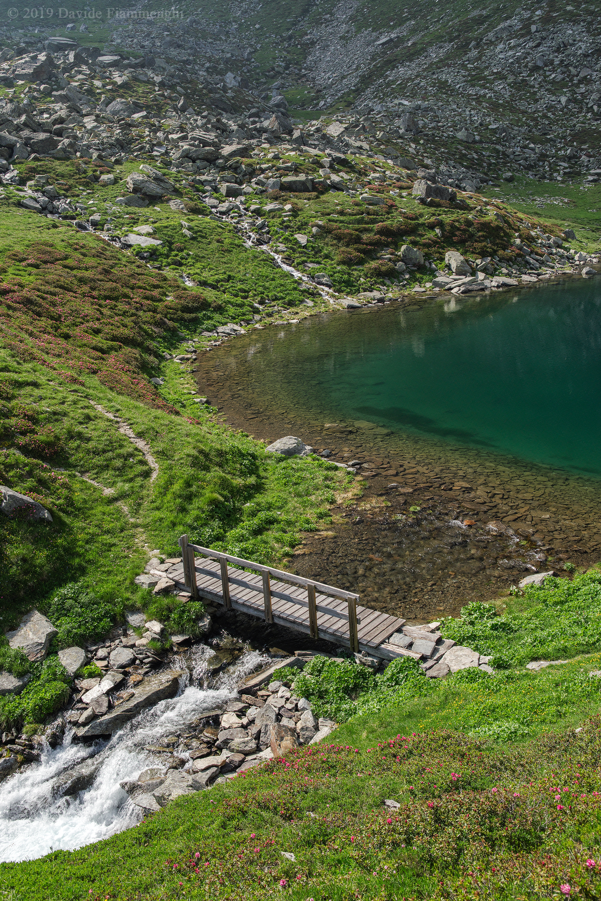
Time passes and it is almost 5:00 p.m. when I start to set off on the return path. In the first photo you can see the path surrounding the whole lake and in the background the Lei pass, with the clouds that suggest that it is better to go back downstream. In the second one you can see the wooden bridge that crosses the Acquafraggia stream, emissary of the lake and in the background the stream that comes from the nearby small lake of Piangesca (2098 m).