North towards Spluga
January 2020
It’s Saturday morning and my photo tour begins from lake Garlate, along the route of Via Spluga (also known as Via Aurea) towards the Splügen Pass, a former Roman consular road that connected Milan with Lindau in Bavaria and have been retraced in 1928 by Highway 36. I am just South of Lecco, where the River Adda, immissary and emissary of Lake Como, forms two small lake basins, Lake Garlate and Lake Olginate, namesakes of the respective cities.
Pescate is a town already mentioned by Alessandro Manzoni in the novel The Betrothed chapter XXXVII, it is said that Renzo arrived at dawn after a rainy night coming out of the leper colony. The famous Farewell to the mountains of chapter VII refers precisely to Lake Garlate, indeed a boat was waiting for Lucia at the mouth of Stream Bione.
In this panoramic photo you can see on the left the cycle path that runs along the River Adda and leads to the center of Milan. In the calm water are reflected the Lecco Alps, specifically the Grigne group, and the Bione area of Lecco city.

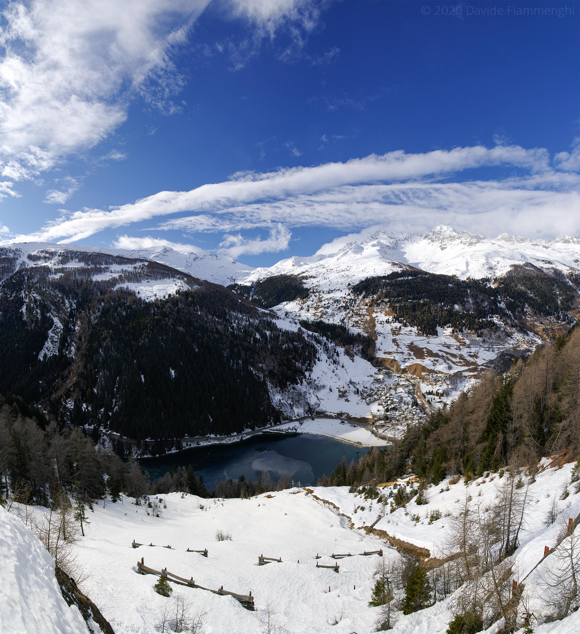
The second stage is 90 km north. I drive along the Como lake on the left bank, further on the board of natural reserve Pian di Spagna and then I enter Valchiavenna. From Chiavenna city begins the Spluga Valley, crossed by the Stream Liro, which thanks to a dam forms the Lake of Isola (1260 m), which takes its name from a town, once a municipality, today a hamlet of Madesimo.
This panoramic photo is the twin of the one taken last August, this time obtained by assemblying 15 hand-held shots, the original is a 146 million pixels file and can be plotted on a one metre wide poster in finest resolution.
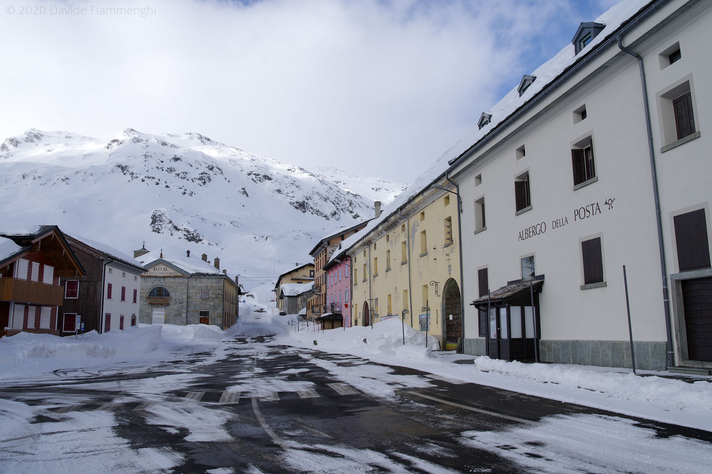
And here I arrive at the gates of Madesimo, on the left is the way to Splügen Pass that leads to Switzerland, the pass is always closed in winter, but since in the previous days there had been a risk of avalanches, I had made sure that it was open the last section of the highway 36 leading to Montespluga. You don’t need to be an expert to realize that this is the warmest winter of the last 30 years, when you reach the altitude 1908 m you still encounter a bit of cold, at 1:00 p.m. it’s -3 °C.
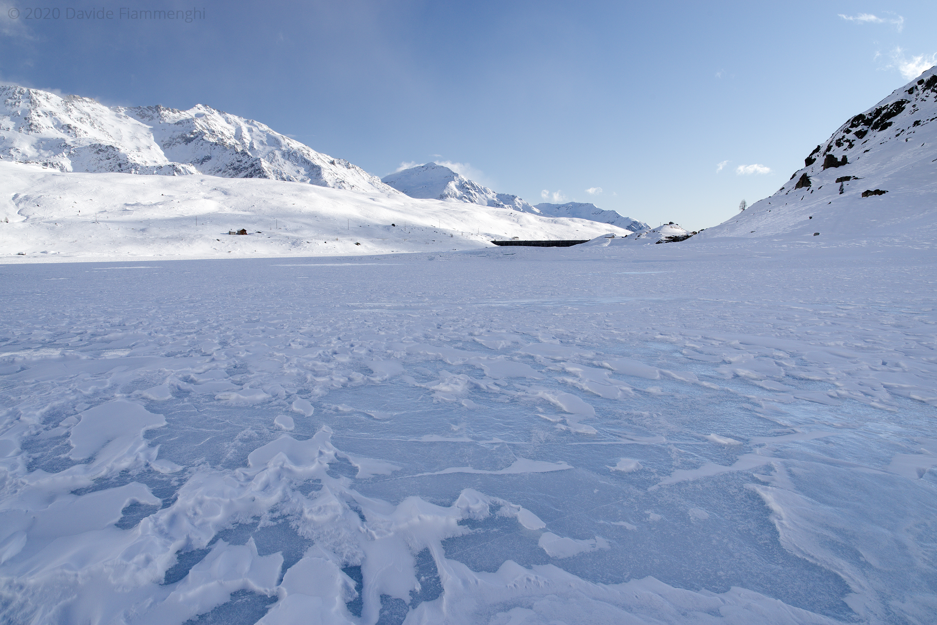
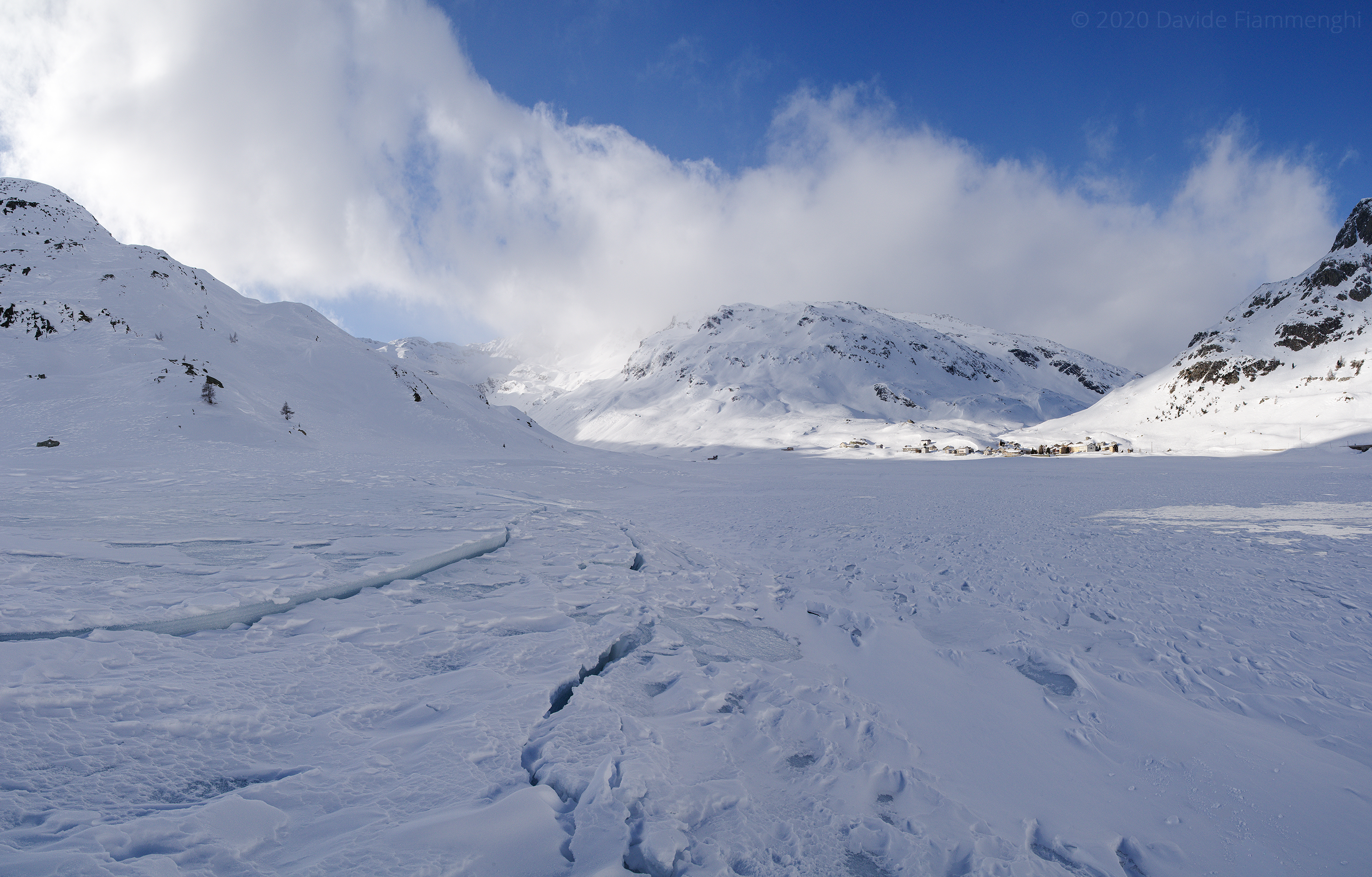
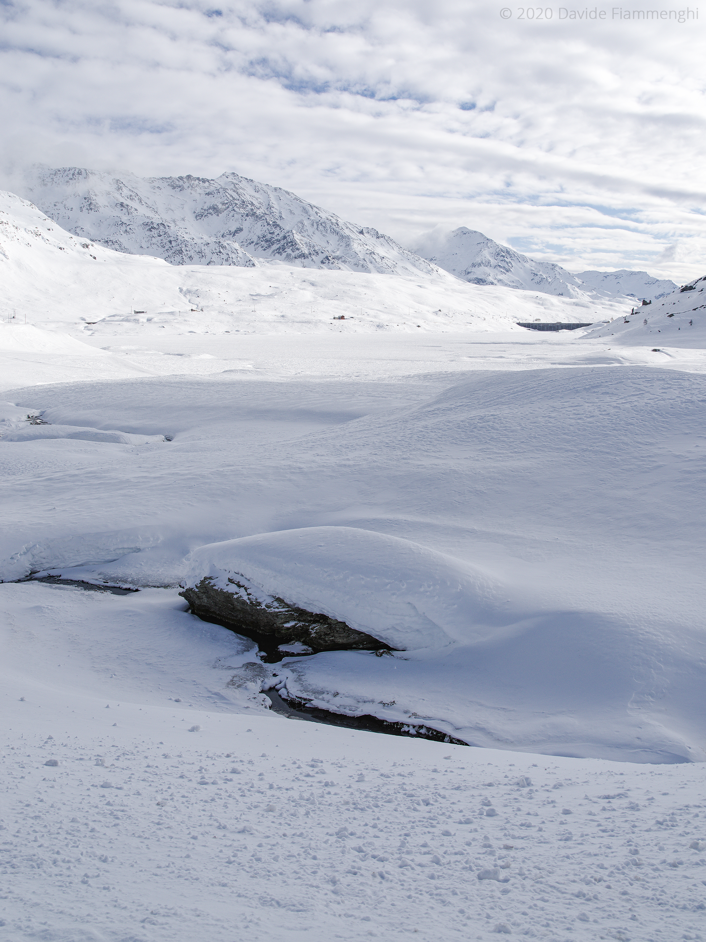
After the dam, whose facade shows the year of construction in Roman numerals “MCMXXXI”, near Stuetta the frozen Lake Montespluga surrounded by snow-covered Alps is immediately visible. The village that gives its name to the lake is desolate, the business is closed, and the road to Splügen Pass is suddenly interrupted on a 1.5 metres wall of snow. There are only a few people who practice winter sports on and near the lake.
I start hiking south in the snow that covers the frozen lake, and I find a uncovered stretch of Liro, a stream that originates near the border with Switzerland and forms the Lake Montespluga through the dam barrier. I go on for about two kilometres in the middle of the basin, while at 2:00 p.m. the sun is already hiding behind Mount Cardine.

The surface of the lake draws interesting patterns of blue ice and white snow, the fractures in the ice are colored with aquamarine, the snowy mountains to the north reflect the golden light of the sunset and the lake shines magically.
I return back to the village Montespluga when at 4:20 p.m. the temperature has dropped to -6 °C and it starts to get dark. I no longer see a living soul around, I will stop in Madesimo for a cup of hot tea before going back home.